laser scanning
Axis delivers high-precision reality capture of existing conditions using advanced 3D laser scanning technology. We provide accurate 3D BIM models and 2D CAD files tailored for the architecture, engineering, and construction industries. Our focus on data accuracy helps minimize project delays, reduce costly errors, and support informed decision-making from design through construction.
scanning SERVICES
Laser scanning
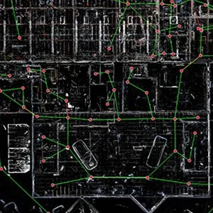
Uses a 3D Scanner to capture data points of existing structures, for accurate and reliable measurements, while taking panoramic photographic images of the structure
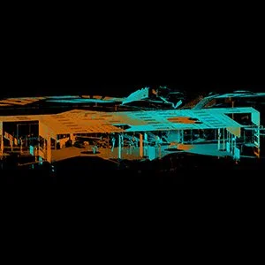
Generate Point Cloud
Specialized software processes the scan data into a clean 3D environment, that allows users to virtually “walk through” the space and take measurements
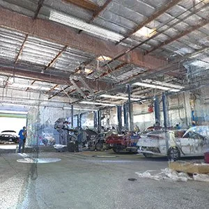
Document Existing Conditions
Creation of accurate 2D CAD drawings or 3D BIM model of the existing structure for use in design and renovation projects